Meriwether Lewis
Explorer Meriwether Lewis, who joined William Clark to blaze a trail across the continent to the Pacific Ocean, was born on August 18, 1774, near Charlottesville, Virginia.

Lewis grew up roaming the woods of Albemarle County, near Monticello, the home of Thomas Jefferson. When Jefferson assumed the presidency in 1801, he selected Lewis as his private secretary. Two years later, Jefferson appointed Lewis to lead an exploration of the Louisiana Purchase—the vast territory that the U.S. acquired from France in 1803.
Known as the Corps of Discovery, the expedition set out from Camp River Dubois on May 14, 1804, heading northwest on the Missouri River. They hoped to discover a Northwest Passage—a water route to the Pacific Ocean. The expedition wintered in present-day North Dakota, traveled to what is now Montana, and reached the mouth of the Columbia River in present-day Washington before returning to St. Louis on September 23, 1806.
Lewis and Clark kept detailed journals of their three-year journey. Originally published in 1814, the journals generated excitement about the unknown region and diminished Easterners’ fears about venturing beyond the Mississippi

Captains Lewis & Clark holding a council with the Indians. Illus. in: A journal of the voyages and travels of a corps of discovery: under the command of Capt. Lewis and Capt. Clarke of the Army of the United States […] Philadelphia: Printed for Matthew Carey, 1810. Prints & Photographs Division
For their part in the three-year adventure, Lewis and Clark each received 1,600 acres of public land. Popular acclaim led to Lewis’ assumption of the governorship of the Louisiana Territory and Clark’s appointment as governor of the Missouri Territory. Meriwether Lewis died of mysterious circumstances—either by suicide or murder—on October 11, 1809.

BLOG POST COURTESY – LIBRARY OF CONGRESS
BUY THE BOOK
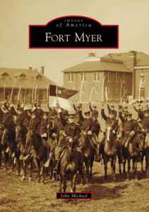
Images of America – Fort Myer is a pictorial chronicle of the first one hundred years of history containing over two hundred photographs, maps, and images. Beginning in the 1860s and carrying through the 1960s it provides a view of what was over time. An autographed copy of the book can be purchased at BUY THE BOOK.

OMAHA STEAKS
YUMMY … STEAKS~!
Learn More
- Search on Meriwether Lewis in the Thomas Jefferson Papers, 1606 to 1827 to locate over fifty documents, including Lewis’ letter to Jefferson announcing the expedition’s return to St. Louis in September 1806.
- Explore the collection Louisiana: European Explorations and the Louisiana Purchase to find additional materials related to the Louisiana Territory. This presentation focuses on the various documents—from maps to newspapers to cultural artifacts—that help to describe the region of North America that stretched from as far east as Alabama into what is now the state of Montana. The items presented here come from the various special and general collections of the Library of Congress.
- Visit the Library’s online exhibition Rivers, Edens, Empires: Lewis & Clark and the Revealing of America to learn more about the Lewis and Clark expedition. This exhibition features the Library’s rich collections of exploration material documenting the quest to connect the East and the West by means of a waterway passage.
- By the 1840s, thousands of Americans were making their way through territory explored by Lewis and Clark over thirty years before. The collection “California as I Saw It”: First-Person Narratives of California’s Early Years, 1849 to 1900 brings together 190 first-person narratives of westward journeys, many written by settlers who embarked in the 1840s and 1850s.
- See early maps of cities that grew up along the trail of the Lewis and Clark expedition. Search in the Cities and Towns collection to find maps of St. Louis, Omaha, or Portland. Also, search on the term Lewis and Clark to see maps relevant to their expedition such as the map of Lewis and Clark’s track, across the western portion of North Amerca… found in the Discovery and Exploration collection.
- Search on Louisiana Territory in A Century of Lawmaking for a New Nation: U.S. Congressional Documents and Debates, 1774-1875 to read congressional acts and proceedings related to the vast territory. This collection also includes a legislative timeline that examines the role of Congress in the Louisiana Purchase from 1802 to 1807.
- See the entries for Jefferson’s Secret Message Regarding the Lewis & Clark Expedition and the Louisiana Purchase in the Library’s Primary Documents in American History Research Guides series.


